Roche Percee, an unusual formation of rocks in southeastern Saskatchewan, was the destination of this day trip with a friend.
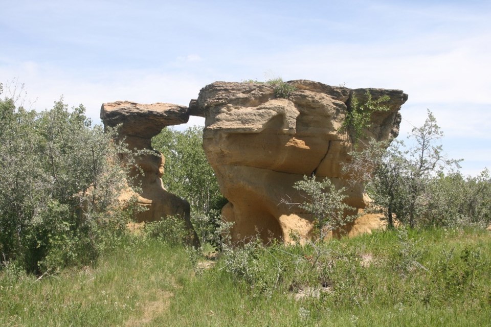
The “pierced rock” formation in the 37-acre historic heritage park was named by early Metis hunters.
The site was sacred for Indigenous people and used to contain petroglyphs.
When the North-West Mounted Police made that long trek west in 1874, they camped near here and remarked on the rocks. Some carved their names in the soft sandstone rock.
None of the petroglyphs nor the Mountie names are still visible.
Newer carved names, initials and erosion have obliterated them.
Our destination involved almost four hours driving to get there, including 25 minutes wasted when we took a wrong turn. The route is Highway One east to Highway 39, down Highway Six to the Estevan bypass highway and on towards North Portal.
On this warm, sunny mid-June day, the green carpets of new crops were everywhere, with the exception of a few flowering canola fields.
Coronavirus notwithstanding, we made the trip, packing a lunch to avoid any potential human contact. The only human contact we made was re-fueling with gasoline once.
The narrow winding road from the highway into the pretty village of Roche Percee is itself scenic and worth the drive. A doe and fawn crossed the road ahead.
Driving into the village it is hard to believe that nine years ago most of this area was flooded when the Souris River overflowed its banks.
The population fell to 110 from 153 in a few years as many folks never rebuilt. A drive on a long street with homes backing onto a berm next to the river explained loss of people.
Only two or three of the houses appear occupied. Several houses appeared abandoned. We saw two or three vacant lots. The rest of the lots had a camper or RV parked where the house once sat.
The highway crossed a meadow and up the hill where we saw the rocks protruding from the hill among the bushes.
After having a leisurely lunch at the picnic table, we walked up the path to the rocks, finding it hard and steep — probably due to our age and dearth of climbing experience.
We drove west along the park, stopping at a foot path entrance. My friend chose not to walk the path, fearing ticks.
Yours Truly walked up the path to the most photographed of the rocks — an archway under which one can walk. Scanning the rocks for old initials or petroglyphs found only newer carved names and initials.
We headed east for a ways, noticing the old mounds of dirt pushed up on the hills north of the river. They were left from open pit coal mining in the 1890s after the Soo Rail line came through.
Then we took Highway 18 towards Alameda and the dam east of that town. On the way to the dam we saw a burial service in the cemetery with about 30 people.
The Alameda Dam, almost a mile long and 138 feet high, was controversial with strong opposition delaying construction. Critics said the dam would take 20 years to fill with water. They were wrong. A few years after 1994 construction the dam was full.
The main purpose was to hold back flood waters from the Souris to the United States.
Ron Walter can be reached at [email protected]


